Hiking
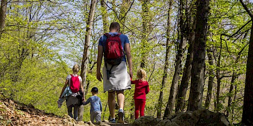
Hiking in the San Juan Mountains can't be beat
To help navigate through the high-alpine trail routes we call paradise, please review our Mountain Village hiking trail map.
Dogs are allowed on trails but as a courtesy to your fellow hikers, please make sure you pick up after your pet. Bags are provided at trailheads. Fines apply if you do not pick up after your pets.
It is important to note, that our trails are not patrolled and there are risks associated with strenuous physical exertion, so for your safety, please be sure to review our mountain activity safety guidelines.
Most importantly, have fun … and share your memories on Facebook, Instagram and Twitter!
Beginner Trails
Big Billie’s - 0.5 miles
Beginning on the south side of Country Club Drive in Mountain Village, this refreshing .5-mile trail winds down 200 feet and ends at Big Billie’s Apartments in the Meadows neighborhood.
Boulevard - 2.5 miles
From Lost Creek Lane near Mountain Village Center, this easy 2.5-mile trail begins on a paved surface and continues to Market Plaza. Once at Market Plaza, the paved trail becomes a natural surface trail and continues west towards Highway 145 and the entrance to the Town of Mountain Village. Watch for signage and road crossings.
Jurassic - 1 mile
This scenic 1-mile trail begins on the north side of Country Club Drive in Mountain Village and to the left of the Boomerang Trailhead, then follows the ridge west and 300 feet down into the Meadows neighborhood.
Meadows - 1 mile
Starting in the Meadows neighborhood in Mountain Village, just up the road from where Adams Ranch Road crosses Prospect Creek and .5 mile west of Big Billie’s Apartments, this one-mile trail drops 200 feet to the Lawson Hill neighborhood and Highway 145.
Overlook - 0.2 miles
This 0.2-mile trail starts at San Sophia Station and offers a bench with scenic overlooks of the Telluride valley below.
Russell - 1 mile
From the intersection of Adams Ranch Road and Russell Drive, this easy 1-mile trail begins on the shoulder. The trail continues below Russell Drive onto a dirt surface and connects with the Meadows neighborhood.
Intermediate Trails
Prospect to Alta Lates - 2 miles
From Prospect Trail or Basin Trail, this trail follows a historic U.S. Forest Service dirt road approximately two miles to scenic Alta Lakes and the historic mining town of Alta. Vehicles may be encountered.
Boomerang to Valley Floor - 1 mile
Beginning on the north side of Country Club Drive in Mountain Village and to the right of the Jurassic Trailhead, this steep 1-mile abandoned mining road descends through the Uncompahgre National Forest to the Valley Floor below. Expect a 700-foot elevation change.
Coonskin Loop - 1.3 mile loop
Beginning and ending at San Sophia and with an elevation change of 170 feet, this dirt ski service road is a short 1.3-mile loop starting from and returning to San Sophia Station. It crosses over Telluride Trail, Lookout and Milk Run ski trails and serves as bike access for the See Forever Trail.
Prospect - 10 miles
Ten miles in length and the longest single-track on the ski area, this trail begins at San Sophia Station and traverses across numerous ski trails under Lifts 4 and 5 and into Prospect Creek. After crossing Prospect Creek, the trail climbs through dense forest to the top of Lift 10. This trail then continues two ways: either along the upper loop through Prospect Basin or a shortcut past the teepee and the top of Lift 10 before the descent begins to Market Plaza. For a longer hike or bike, Prospect Trail also connects with the Boomerang Trail which leads to Alta Lakes.
Ridge - 2 miles
This hiking-only trail begins at Station San Sophia, dropping over 1,000 feet over the course of 2 miles down to Station Mountain Village and Mountain Village Center. With its valley views and peaceful switchbacks throughout the aspen forest, this trail is a local favorite. Do watch for a fork in the trail about 0.2 miles below the radio tower as the route to the right is more rocky and steep.
Sheridan - 2 miles
This 2-mile trail begins at San Sophia Station and continues to the right, where the trail forks near the top of Lift 4. It then follows a dirt ski service road to the winding, steep and paved San Joaquin Road, 1 mile from Mountain Village Boulevard. Vehicles may be encountered.
Village - 3 miles
From San Sophia Station, this rolling 3-mile descent crosses several ski trails with great views to the west while traversing through aspen and spruce-dominated drainages. After crossing Prospect Creek Drive, this trail descends into a creek bottom, crossing the wetland on a boardwalk, and then continues down and connects with the Boulevard Trail, providing access to Market Plaza and Mountain Village Center.
Advanced/Expert Trails
Beginning at San Sophia Station, this trail forks with the Sheridan Trail and continues left, past the snowmaking storage ponds and gate, for 6 miles on a dirt ski service road. There is 2,240 feet of steep climbs and descents past the top of Lift 5, the bottom of Lift 14, past Lift 12 and down through the ski area to connect with Prospect Trail. Vehicles may be encountered. The hiking-only portion of this trail starts .2 miles south of Station St. Sophia. For bikers, the access point to the See Forever Trail is from San Sophia Station via the Coonskin Loop Trail. Steep and strenuous, this dirt ski service road climbs along the ridgeline 1,710 feet in 2.8 miles to the Wasatch Connection Trailhead. Vehicles may be encountered. With 360-degree views of surrounding mountain ranges and peaks, this trail is often combined with the Wasatch Connection to the Wasatch Trail to form an all-day, 8.3-mile, 3,510-foot steep descent onto Bear Creek Trail, leading into the Town of Telluride. Accessing this trail from either the Town of Telluride or off Coonskin Loop Trail in the Town of Mountain Village makes no difference: either way its 2.6-miles of steep, rocky terrain only accessible on foot. Sorry to shout, but NO BIKING ALLOWED as people have been hurt doing so. This trail follows a dirt ski service road from San Sophia Station 1,800 feet down to the Town of Telluride. Vehicles may be encountered. This steep and rocky 1.4-mile trail connects the See Forever Trail to the Wasatch Trail that leads to the Bear Creek Trail. The Wasatch Connection drops off the backside of Gold Hill. Combine these trails for an arduous, day-long adventure.Basin - 6 miles
See Forever - 2.8 or 8.3 miles
Telluride - 2.6 miles
Wasatch Connection - 1.4 miles